YachtAçor
Azores - Boat Charter
I'm a Title. Click to edit me
Azores
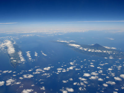
There are nine major Azores islands and an islet cluster, in three main groups. These are Flores and Corvo, to the west; Graciosa, Terceira, São Jorge, Pico, and Faial in the centre; and São Miguel, Santa Maria, and the Formigas Reef to the east. They extend for more than 600 km (370 mi) and lie in a northwest-southeast direction.
The vast extent of the islands defines an immense exclusive economic zone of 1,100,000 km2 (420,000 sq mi). The westernmost point of this area is 3,380 km (2,100 mi) from the North American continent. All the islands have volcanic origins, although some, such as Santa Maria, have had no recorded activity since the islands were settled. Mount Pico, on the island of Pico, is the highest point in Portugal, at 2,351 m (7,713 ft). The Azores are actually some of the tallest mountains on the planet, measured from their base at the bottom of the ocean to their peaks, which thrust high above the surface of the Atlantic.


Flores
Flores Island is the westernmost point of Europe, with an area of 142 km2 and a population of 4300 inhabitants.
It was discovered in 1450 by Diogo de Teive and his son John Teive. The beginning of its settlement, occurred during the reign of D Manuel I, in 1510, with people from various regions of the continent, mainly from the north of the country.
Flowers are one of the most beautiful islands of the Azores. In summer the island is covered with thousands of blue hydrangeas, which divides the fields along the roads, on the edges of streams and ponds. It was in vain that called it Ilha das Flores.


Corvo
The smallest island in the Azores, Corvo account only 17.45 km2 in area and 400 inhabitants. It is a different point in the middle of the immensity of the Atlantic. The Crow's sole town of Vila Nova do Corvo.
Discovered in 1452 by Diogo Teive began to be populated in 1458 by slaves and black Moors, ranchers and from 1580 by the white population coming from Flores Island.
The highest point of the island is Mount Grosso with 770 m height. The Corvo consists of a volcanic cone whose top fell-shaped boiler, forming the Cauldron, which is an extinct crater the altitude of 770 m in height with 3, 7 km perimeter and 300 m deep.
The population dedicated to farming and fishing.


Graciosa
Graciosa Island, belongs to the Central Group of the Azores archipelago. It has an area of 60.84 km2 and a population of 5500 inhabitants. It measures 10 km long and 7 km wide.
According to some authors, was discovered on May 2, 1450 being its first settler Vasco Gil Sodré, natural Montemor-o-Velho.
The landscape is very beautiful Graciosa, where it mixes with the green trees of the white villages and isolated houses. The ex-libris of Graciosa is a large rock formation near the existing town of Santa Cruz, with a setting much like a whale.
Of volcanic origin, the Island Graciosa has a very sharp relief in the southern part, where is the peak of the boiler with 402 m. On the coastline, rugged, open up two stalls where are the port town of Praia da Graciosa and Santa Cruz.
It has fertile fields that produce cereals, fruit and wine and raise cattle.


Terceira
As its name indicates, was the third island of the Azores Archipelago to be discovered.
Terceira Island is 29 km long and 18 km wide, measured the circumference 90 km and an area of 396.75 km2. Its population is 59 000. The highest point of the island is of me in 1022 is located in the Sierra de Santa Barbara.
Terceira Island played a major role at the time of the discoveries due to its good geographical location.
The landscapes of the island are of great beauty, with very distinctive features, like the view of Serra do Cume. The area west of the island is covered with lush vegetation and there are many cedars. On the north coast, one can observe the tip of the "mysteries", with its traces of volcanic eruptions.
The economy of the Third, based mainly on farming and industrial beneficiation of products built on its territory. It has two harbors in its two cities, Angra do Heroismo and Praia da Vitória, where is the international airport and Lajes. The city of Angra do Heroismo, is the oldest city in the Azores (1534) and at the same time seat of the diocese, erected on 3/11/1534.
One can not speak of Terceira not to mention the feast of the Holy Spirit. This cult is linked to Queen Isabel and the miracle of the roses turned into bread. This miracle is repeated every year in towns and villages of the island of Terceira in the ceremony of distribution of bread and meat for the population. This is a ritual that dates back to the Middle Ages that is repeated throughout the centuries with a deeply religious feeling.
The other great party and great traditions on the island is the "race to the rope." A bull with a rope attached and controlled by two groups of four pastors invest against popular that spread through the streets of the villages.
São Jorge
The Sao Jorge Island, situated in the center of the Central Group of the Azores archipelago, separated from Pico Island by a channel of 15 km. St. George is 56 miles long and 8 miles wide, and its total area of 246, 25 km2 and a population of 10 500 inhabitants.
The first reference to this island dates from 1439, but this was actually only twenty years later populated with settlers from the northern provinces of the mainland. St. George, is like most of the Azorean islands of volcanic origin.
The great feature of this island are the Fajãs, but almost all inhabited access very difficult. On the north coast, there are the Fajãs the Ombudsman, the Cubres and Santo Cristo. On the south coast, the most important is the Faja dos Vimes.
This island is traversed by a mountain range which reaches an altitude of 1053 m, the peak of Hope. The coast is generally rocky. Produces cereals, fruit and vines and raises cattle. Another activity of the island is fishing and dairy industry.
Pico
This is the largest island of the Central Group of the Archipelago. Situated at 38 ° 30 'North and 28 º 20' West.
Pico is a distance of about 8km from the island of Faial, and about 15Km from S. Jorge has an area of 447 km2 and has a population of 15 500 inhabitants. Measures 42 km long and 15.2 km wide.
Discovery before 1439, began to have the designation of St. Denis. Its settlement was started in 1460 and became final from 1482 with the founding of St. Matthew.
Its name originates from the high mountain that dominates and ending in a sharp peak, being the highest of Portugal. Pico is the most mountainous island in the Azores, reaching the summit of Peak 2351 m high.
The very jagged coast, presents some curious aspects emphasizing the whole Rocky Arc Dog in the bay of the same name. The vine cultivation dominates the western region of the island is the famous "Pico Verdelho" grown geometrically between walls made of loose rock.
Faial
Situated at the western end of the Central Group of the Azores archipelago, at 38 ° 36 'North and 28 and 30'Oeste, Faial Island is separated from Pico Island by a channel about 8.3 km wide (4.5 miles).
It has an area of 173.4 km2 (67 milhas2) and a population of 16 000 inhabitants.
Of volcanic origin, the Azorean island is more subject to earthquakes.
Its shape is an irregular pentagon (25 km 20 km), and the center has a boiler with an altitude of 1021 m and its highest point is 1043 meters with Cabeço Gordo.
In some letters came to be called "Insula de Ventura." Discovery in the first half of the fifteenth century, the beginning of its settlement occurred around 1460. Its rapid economic growth was due in large part to the culture of pastel plant that supplied the blue color that was much used by dyers.
The Faial Island is also well known as "Blue Island" due to the large amount of hydrangeas that bloom on the island in the summer months as this island is the beautiful capital city of Horta, with its well known sea port and marina, almost obligatory stop for all sailboats passing through the waters of the North Atlantic.
Peter's bar, next to the port, is the favorite place of all browsers who come here because of its internationally known Gin Tonic.
The island of Faial, still keeps some windmills rare beauty that lend to certain corners of your landscape.
Fields of Faial, producing potatoes, cereals, fruit and vines and create cattle that feeds the dairy and meat.
São Miguel
São Miguel, the largest island of the Azores, is also the most importante.Com an area of 746.82 km2, is 90 km long and 8-15 km wide and has a population of approximately 140 000 inhabitants.
San Miguel is also known as Green Island, due to its endless pastures.
The tourist attractions are varied. Vale das Furnas, the real ex-libris of the island has a vision of paradise with steam boilers, water boiling and mixing that involves with the beauty of the pond. It is difficult to describe a scenario.
With a huge crater, is divided into two parts, called respectively of blue and green.
In the east of the island, is the Pico da Vara - the highest elevation of the island - with 1103 m of altitude. In the central Sierra de Agua de Pau with 940 m height and on the west lies the Boiler Seven Cities with 850 m of altitude.
In its fertile lands, are produced cereals, tea, fruit and wine and feed the cattle.
The first capital of the island was Vila Franca do Campo, which came to be devastated by an earthquake in 1522, when it was moved to Ponta Delgada. Ponta Delgada is a city in constant evolution, where it still maintains its churches and palaces of the sixteenth and nineteenth centuries.
The largest religious festival of the Azores is held on this island, more specifically in the city of Ponta Delgada, where thousands flock every year to people. These are the feasts of Senhor Santo Cristo dos Milagres that are held every year on the fifth Sunday after Easter.
Another manifestation of this island is the religious Pilgrims. At the time of Holy Week, groups of a few dozen men roam the island on foot for eight days, praying and singing in all the Churches and Chapels faced along the way.
Santa Maria
Santa Maria was the first island of the Azores Archipelago to be discovered. Diogo Silves who was discovered during a return trip from Madeira, stemmed the year 1427.
This island has an area of 97 km2 and a population of 6500 inhabitants. The island's capital, Port Vila is the oldest Azorean villages, where you can still see traces of old houses, which belonged to Captain Grantee windows of the fifteenth century.
Santa Maria is the only island in the Azores with large proportions of land of sedimentary origin, where you can find marine fossils.
The houses are scattered throughout the island reminiscent Alentejo houses with large chimneys. The land is very fertile and the countryside is very beautiful.